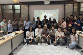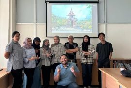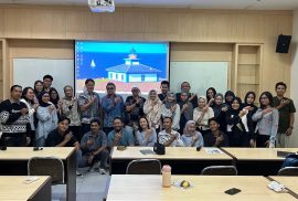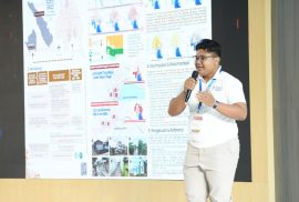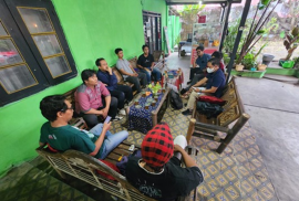
The new cohort of the Master of Urban Design Program (Batch 9) conducted the Matriculation Program for Urban Design Studio Preparation from February 2–6, 2026. This activity marked an initial stage in entering the academic process for the even semester of the 2025/2026 academic year. The Salatiga City Center area was selected as the study object for the Urban Design Studio, providing students with the opportunity to directly observe the dynamics of an urban area with its unique characteristics, potentials, and challenges within the context of urban design.
On Friday, February 6, 2026, the Master of Urban Design Program organized a public lecture to mark the beginning of the even semester of the 2025/2026 academic year. The event was conducted in a hybrid format, held offline at Lecture Room 1, 3rd Floor, North Wing of DTAP FT UGM, and simultaneously accessible online via Zoom Meeting. Open to the public and alumni, the lecture provided a platform for knowledge exchange and engagement beyond the academic community, fostering a broader discussion on contemporary urban design issues.
Warid Zul Ilmi (Warid) is the first student of the research-based master’s program, known as the Master by Research (MBR), at the Master of Urban and Regional Planning (MPWK), Faculty of Engineering, Universitas Gadjah Mada. He joined MPWK UGM in the Even Semester of the 2023/2024 Academic Year, bringing strong enthusiasm and dedication to research as a means of understanding, interpreting, and responding to various urban development challenges. He succesfully graduated with Cum Laude Honors on January 2026.
The Community Service Team – Building Technology Research Group, Architecture Study Program of Universitas Gadjah Mada (UGM) Yogyakarta, in collaboration with the Gedongkiwo Tourism Awareness Group (Kelompok Sadar Wisata/Pokdarwis), conducted a Tourism Planning Program for Gedongkiwo Urban Village, Mantrijeron District, Yogyakarta City in 2025. This activity aimed to encourage the development of community- and culture-based urban tourism through a sustainable spatial planning and architectural approach.
Author: Computational Spatial Planning Laboratory, DTAP, UGM
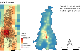
Understanding urban spatial structures is fundamental for guiding equitable and sustainable urban development, particularly in cities undergoing rapid transformation in the Global South. Conventional approaches often depend on fixed administrative boundaries or outdated planning models, which inadequately reflect the fluid and evolving nature of urban spatial dynamics. These traditional frameworks tend to overlook the complex interactions and functional linkages that shape urban form and activity patterns, thereby limiting the effectiveness of urban planning and policy interventions. To address this gap, our study introduces an integrated geospatial methodology that combines diverse spatial datasets and advanced analytical techniques to delineate urban centers and sub-centers more accurately. By applying this approach to Magelang city and region in Central Java, Indonesia, the research highlights how combining multiple scales of spatial data—such as land use, transportation networks, and socio-economic indicators—can reveal nuanced spatial structures that traditional methods miss. This multi-scale analysis not only enhances the understanding of urban spatial functions but also provides a robust framework for planners and policymakers to identify emergent urban patterns and support more adaptive, context-sensitive urban development strategies.
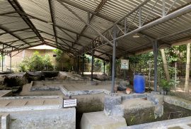
Inventory and documentation are integral parts of heritage area planning and serve as a fundamental basis for overall heritage conservation. The inventory and documentation of heritage areas aim to generate comprehensive information on existing heritage assets within a particular area, including their presence, descriptions, and assessments of significance. The compiled heritage information is then used as a reference for decision-making in planning processes.
One of the challenges faced by Indonesia is that many heritage assets: natural, cultural, and cultural landscapes, are still poorly documented or have not been documented at all. As a result, many of these assets have deteriorated or even disappeared. Village-level heritage assets, including those in villages across the Special Region of Yogyakarta, are also facing threats such as declining heritage values due to a lack of public awareness, neglect, and increasing development pressures.
The cool atmosphere of the slopes of Mount Andong in Girirejo Village, Ngablak District, Magelang Regency, now offers more than just the beautiful scenery typical of mountainous areas. Over the past few years, this area has also become a living laboratory for a team of lecturers from the Architectural Design Expertise Group, Department of Architecture and Planning Engineering, Faculty of Engineering, Universitas Gadjah Mada, who have consistently accompanied the local community in developing sustainable, community-based tourism potential. This community service program, which has been running since 2022, has now entered its fourth year of implementation.
All students are hereby informed that the re-registration for the Even Semester of Academic Year 2025/2026 will be conducted in accordance with the regulations and schedule stipulated by the University. Students are expected to carefully review the following information and complete the re-registration process in a timely manner.
Prior to submitting applications for semester leave, reactivation of student status, study period extension, as well as tuition fee (UKT) reduction or deferment, students are required to first obtain letter approval through the SMS FT Correspondence System. Guidelines and correspondence procedures can be accessed via the following link: https://archiplan.ugm.ac.id/id/alur-persuratan/. Once the letter has been approved, the relevant applications may then be submitted through SIMASTER.
Prof. Ir. Bakti Setiawan, M.A., Ph.D., widely known as Prof. Bobi, an academic in Urban and Regional Planning at the Faculty of Engineering, Universitas Gadjah Mada, served as a speaker in the talkshow “Ruang-Ruang yang Menginspirasi” on Thursday, 18 December 2025. The event was held at the RBTV Jogja Studio, Universitas AMIKOM Yogyakarta. The talkshow provided a public forum to discuss spatial planning issues and the development of strategic areas in the Special Region of Yogyakarta.
The discussion focused on the role of Strategic Spatial Units (Satuan Ruang Strategis/SRS) in preserving and strengthening the distinctiveness of Yogyakarta, particularly from a regional planning perspective. SRS were positioned as important instruments that integrate philosophical, historical, customary, social, and environmental aspects in spatial management. This approach underscores the importance of aligning cultural values with regional development needs.
On Friday, 26 September 2025, the Architecture Study Program at Universitas Gadjah Mada (UGM) successfully held an event entitled “MateREALity: AutoConz 3D Construction Printing” as part of the MateREALity 2025/2026 series. The activity was shared via Instagram and featured on the official @architecture.ugm account.
The session focused on the introduction and exploration of 3D construction printing technology as an innovation in the construction industry. The event was organized in collaboration with DEKKSON, which introduced AutoConz technology as one of the breakthroughs in future construction methods.